


These three islands in the Lesser Antilles have been very busy developing their own unique identities. Aruba led the way by being the first to really see a rise in tourism with hundreds of thousands of tourists a year making their way to find refuge on its beaches.
Bonaire, ringed by some of the most fabulous reefs on this earth depends on diving as its main attraction and Curaçao works hard to play hard, mixing commerce (Willemstad is recognized by Unesco) and a combination of serene, hidden beaches and busy, populated beaches.
The Netherlands-influenced islands of Aruba, Bonaire and Curaçao put a refreshing spin on the Caribbean; three separate destinations going in their own distinctive directions.
Generally speaking Aruba will fill with American visitors during the holidays, vacations, and spring breaks. Curaçao tourism tends to increase between December and April (cruise-ship season) and again in August, the vacation time for Europeans. Bonaire doesn’t have a peak season; people come to dive all year round.
A long, long time ago
Curaçao was claimed in 1636 by the Dutch, who developed Willemstad into one of the world’s finest deepwater harbors. Curaçao, nearly equidistant between Aruba and Bonaire, is, at 171 square miles, the largest of the three islands as well as the most populated and least dependent on tourism. To the west lies 74 square miles of Aruba, the smallest of the trio, Aruba relies on an oil refinery in San Nicolas, near its eastern tip, and boasts a string of high-rise resorts along white-sand Palm Beach near the west end to accommodate a constant flow of vacationers. Over Aruba’s eastern horizon lies boomerang-shaped, 113-square-mile Bonaire. It used to depend on saltworks and aloe plantations until the mid-1970s, until the lightly populated island caught on as a world-renowned diving destination.
Lay of the land
All three islands are flat and scrub-covered. All bear cactus trees, rough and spiky bushes, and the famous divi-divi trees.They feature rugged rolling hills of forest, limestone coastlines, jagged fringing reefs, and limited rainfall. These characteristics are what earned the islands of Aruba, Bonaire, and Curaçao the Spanish label “islas inutiles,” or “useless islands.”
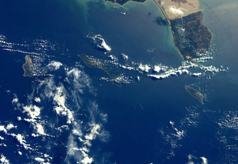
The ABCs make up the Leeward Antilles and are situated off the coast of South America lying north of Venezuela and 500 miles west of the Windward Islands. On a clear day Venezuela, a mere 15 miles from Aruba, can actually be seen. All three boast national parks, the Arikok in Aruba, Cristoffel in Curaçao and Washington/Slagbaai in Bonaire, each with its own compelling history and breathtaking beauty. All three are ringed with colorful Dutch-inspired architecture.
Getting around
Curaçao’s Hato International Airport is on the north side of the island, approximately six miles from Willemstad. Aruba’s Queen Beatrix International Airport, just east of Oranjestad, is a five-mile drive from the Palm Beach resort enclave, and Bonaire’s pastel-pink Flamingo International Airport is just two miles south of Kralendijk. Several local airlines link the ABCs with scheduled inter-island service.
Taxis are plentiful. Drivers charge set fees for point-to-point trips, including airport pickups and drop-offs. On Aruba, good buses link Palm Beach with Oranjestad, but elsewhere in the ABCs, buses are almost exclusively used by locals.
Car rental companies are available on all three. Major roads are well- maintained, and towns and attractions are well-signed.
Don’t worry, be happy
The ABC’s are rarely visited by the hurricanes that haunt most of the Caribbean in late summer and early fall. Count on a brief October–November rainy season otherwise don’t expect rain to get in the way of outdoor activities. Rainfall averages only 22 inches a year. Despite the near-constant sunshine, trade winds keep the islands cool with an average year-round temperature of 82 degrees all the while guaranteeing tourists average water temperatures of a very comfortable 80 degrees.
No Comment